
08
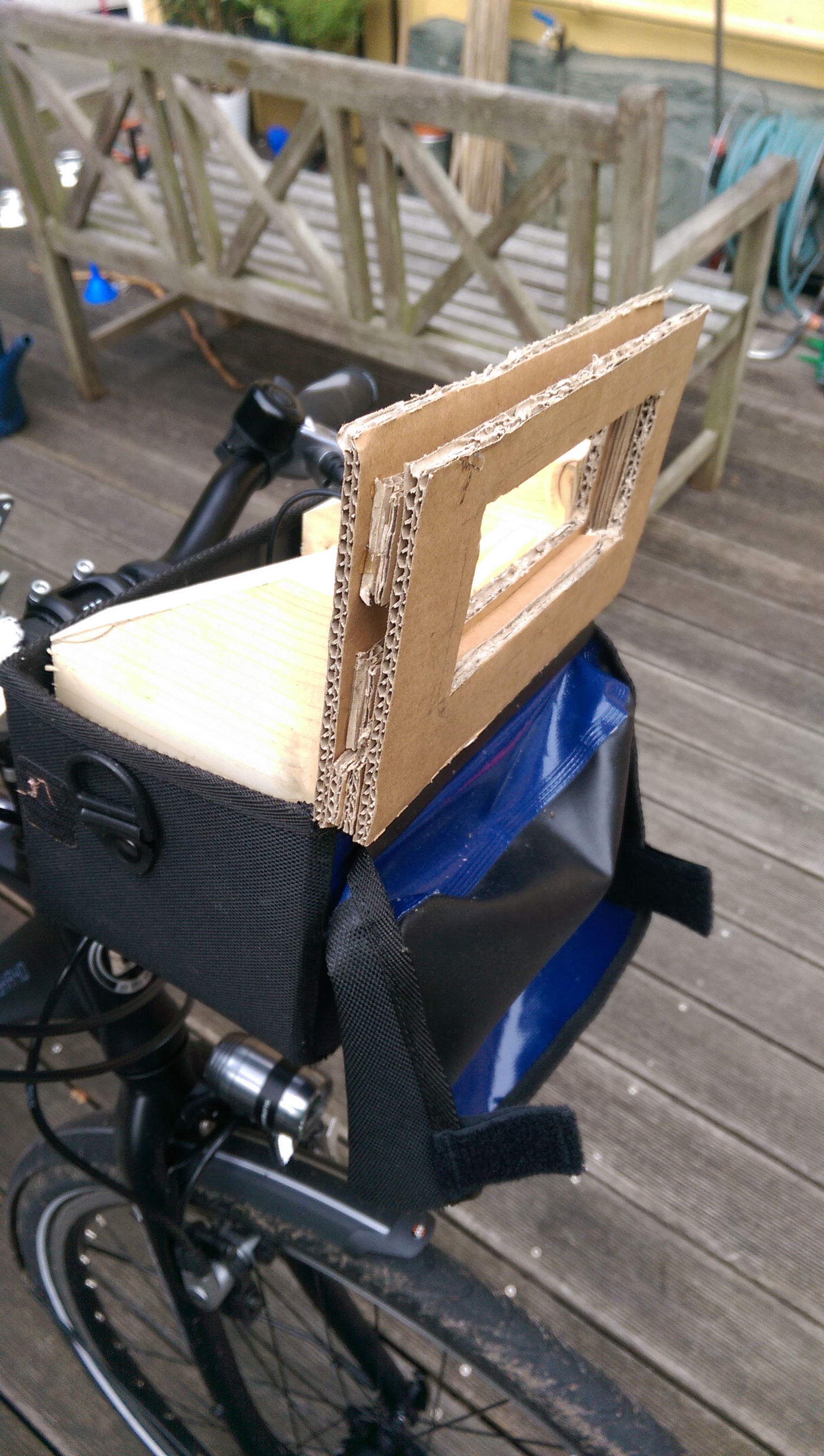
Mapillary Fahrrad Halterung #2
Der 2te Versuch. Ein klein bischen Holz, Karton und Uhu...
Google Groups und GnuPG
Au backe ist Google Groups kaputt. Ich habe seit langem mal wieder in einer gruppe die ich via Mail Lese ein reply geschickt und wundere mich das die GnuPG Signature kaputt ist. Kein Wunder. Google packt eine zusätzliche signature in den signierten Bereich.
Liebes Google - Wie kaputt kann das eigentlich sein?
Florian Lohoff                                                 f@zz.de
     We need to self-defense - GnuPG/PGP enable your email today!

--
You received this message because you are subscribed to the Google Groups "Osmand" group.
To unsubscribe from this group and stop receiving emails from it, send an email to osmand+unsubscribe@googlegroups.com.
For more options, visit https://groups.google.com/d/optout.

[-- End of signed data --]
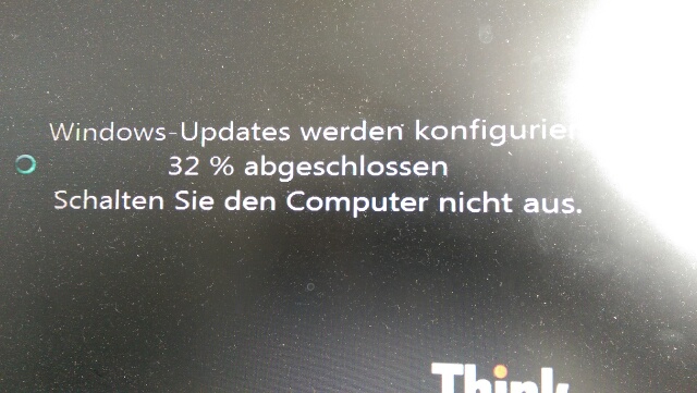
Jeeedesmal wenn ich einmal im Jahr Windows starte
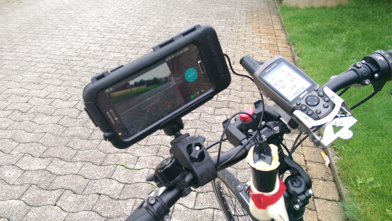
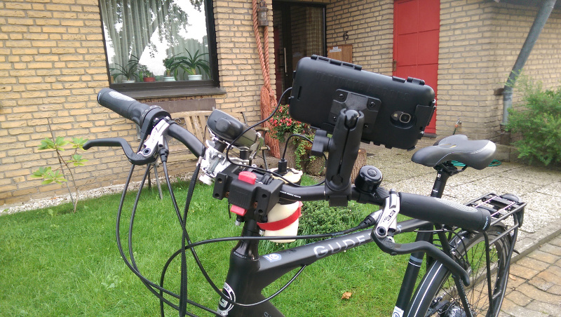
Mapillary setup redesign
Having done some Mapillary imaging last year for example by Car or by bike i thought of using more professional stuff.
The more dense the map gets the more important it gets to actually go back and proof something exists as you mapped it. Mapping sidewalks, cycleways, surface and lit to all streets is a complex and time consuming task. So i plan to take images on all streets of my hometown and surrounding so i can do armchair mapping in the upcoming winter.
An old Galaxy S4 with broken cell receipt and broken glass used as a GPS enabled camera. Then some RAM mount gear and a buybits mobile cage you all can find on Amazon. This is all not cheap but worth the money.
Then i got into the pitfall only having a Class 2 MicroSD in the mobile which made problems storing the images fast enough. So that got replaced by a Class 10 or U1 which solved the problem.
Then on to fix the GPS reception problem with the Galaxy S4 in its cage. Reviving the years old Wintec WBT 201 or better known as G Rays 2. Pairing that with the mobile and using the developer mode of the Android and Blueooth GPS feeds the GPS informations to the mobile.
Now you need to turn off all "no shoot conditions" in the Mapillary app. Tilt, Shake, Face Down, Move too slow etc as the cage rattles a little so the app will basically NEVER shoot an image.
The problem left is that some images are upside down or rotated as the sensor said i was holding the camera upside down. Typically i delete those images but the App is not really user friendly in reviewing 1-2K images a day.
Missbrauch des name tags
Zunehmend finde ich Objekte bei OSM die einen ziemlich obskuren bis kaputten name tragen. So z.b. name=Kuhtunnel oder auch name=Neuer Radweg oder sogar nur ein name=Radweg
Das name tag sollte den namen tragen und nicht eine ausführliche Beschreiben des Objektes oder dessen Nutzung. Das das ein Radweg ist wird sich durch eine Sammlung von highway tags erklären dazu bedarf es keinerlei Beschreibung.
Das ganze fällt immer dann auf wenn wirklich jeder name gerendert wird und dann mit einem durch zufälliges label placement nicht mehr der Name der Bundesstraße sondern dort "Kuhtunnel" steht.
Mal ganz davon abgesehen das dieserlei Namen dann jeglichen Index aufblähen.
Wer sucht schon nach "Radweg".
Ich bin durchaus dafür zwecks Mapper kommunikation strittige Objekte mehr zu beschreiben oder im Freitext zu attributieren. Das sollte dann aber in einem note stehen und nicht im name